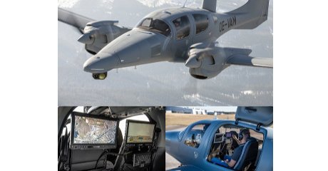
Launching the Aerial Surveys System to update the digital maps of the State of Qatar
The mission of aerial photography covering all parts of Qatar and Halul Island to take 20 cm- accurate evaluative aerial photographs has been completed to update the digital linear maps of the State within the operational phases of the Aerial Surveys Project for Qatar

Estimated reading time: 1 minutes
The project is being implemented by the Geographical Information System Center of the Ministry of Municipality. The photography work took place from the 30th of March to the 20th of April 2022 AD.
It is planned to provide all the institutions of the State with aerial Photographs and updated digital maps during July 2022 to be used within the activities and projects of FIFA Qatar 2022 events. They will be used later in all the other projects of the State in various fields (planning sectors, education, health, Ministry of Interior services, supporting decision making, infrastructure development of the State and others).
The aerial surveys and remote sensing using manned aircraft carried out by Geographic information System Center aims at achieving integration with other data sources that are currently used by the center such as satellite images, mobile field survey and drones. The project is being implemented by khatib and Alami Company after a tender was awarded by the Ministry?s Tenders Committee to supply the devices and equipment of the project including manned aircrafts, modern drones, cameras, remote sensing and specialized computers.
Source: Ministry of Municipality
What's Your Reaction?


